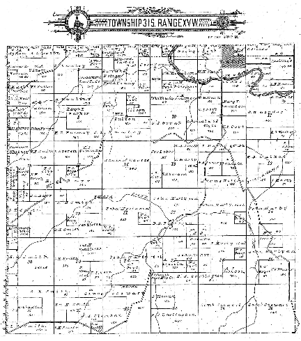

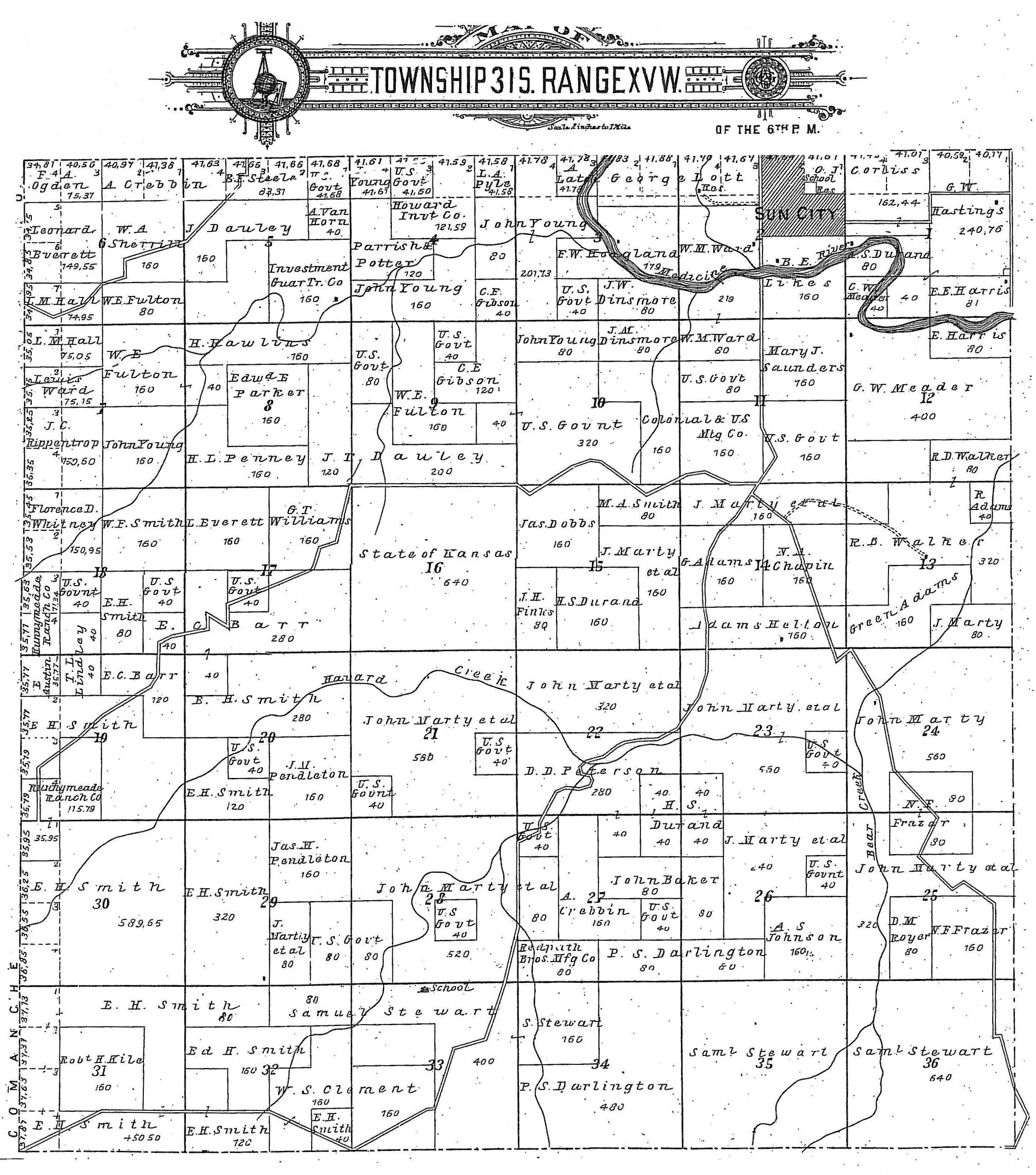
Two copies of this map appear on this page; an overview and a LARGE version.
Use your horizontal & vertical scroll bars to view the large version of the map.
G. Adams,
Green Adams,
R. Adams,
E. Austin,
John Baker,
E.C. Barr,
N.A. Chapin,
W.S. Clement,
Colonial & U.S. Mtg Co.,
O.J. Corliss,
A. Crebbin,
P.S. Darlington,
J. Dauley,
J.T. Dauley,
J.W. Dinsmore,
Jas. Dobbs,
A.S. Durand,
H.S. Durand,
L. Everett,
Leonard Everett,
J.H. Finks,
N.F. Frazer,
W.E. Fulton,
C.E. Gibson,
L.M. Hall,
E. E. Harris,
G.W. Hastings,
Adams Helton,
F.W. Hoagland,
Howard Invt Co.,
Investment Guar Tr Co.,
A.S. Johnson,
Robt H. Kile,
A. Latch,
B.E. Likes,
T. L. Lindley,
George Lott,
J. Marty,
J. Marty et al,
G.W. Meaders,
F.A. Ogden,
Edw & E Parker,
Parrish & Potter,
J.M. Pendleton,
Jas M. Pendleton,
H.L. Penney,
D.D. Peterson,
L.A. Pyle,
H. Rawlins,
Redpath Bros. Mfg Co.,
J.C. Rippentrop,
D.M. Royer,
Runnymeade Ranch Co.,
Mary J. Saunders,
W.A. Sherrill,
E.H. Smith,
Ed H. Smith,
M.A. Smith,
W.F. Smith,
State of Kansas,
B.F. Steele,
S. Stewart,
Saml Stewart,
Samuel Stewart,
U.S. Govt,
A. Van Horn,
R.D. Walker,
Lewis Ward,
W.M. Ward,
Florence D. Whitney,
G. T. Williams,
J Young,
John Young.
Return to History of Sun City, Kansas
Thanks to Kimberly (Hoagland) Fowles for finding and scanning this map for this web site!
This RootsWeb website is being created by Jerry Ferrin with the able assistance of Kim Fowles and many other Contributors.