Trego county was named for Capt. Edgar P. Trego, of Co. H, of the 8th Kansas, who was killed at Chicamauga.
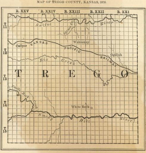
Topography. - The general surface of the country is rolling; somewhat broken in the northern tier of townships along the Saline river - the broken country extending some three or four miles south of the river.
Timber. - The timber supply is scanty, being confined to a narrow belt along some of the larger streams.
Principal Streams. - There are three, traversing the county from east to west - the Saline, on the north; Big creek, through the centre; and the Smoky Hill, on the south. These have numerous tributaries, many of which are fed by springs, while others go dry for a portion of the year.
Coal. - Indications of coal have been discovered on the Smoky Hill river; but no steps have yet been taken to develop it.
Building Stone, etc. - Plenty of good building stone is found in the. county, principally white magnesian limestone; there is also hard limestone in good supply. There are also large deposits of sand and conglomerate rock and sand. Deposits of native lime are found, which makes good mortar without burning.
Railroad Connections. - The Kansas Pacific Railroad passes through the centre of the county from east to west. The stations are Trego and Wakeeney.
Lands. - The Saline valley averages three-quarters of a mile wide. The best lands in the county are between the Saline river and. the Kansas Pacific Railroad, and south of the road to Big creek.
Gypsum. - A large portion of the land is impregnated with gypsum. Out on the open prairie, gypsum is frequently found in a disintegrated state.
![]()
