
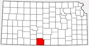
At left: Map of Kansas showing the location of Barber County, courtesy of Wikipedia.
Aetna Township Map, Barber County, Kansas
From Standard Atlas of Barber County, Kansas, 1905. Courtesy of Kim Fowles.Elm Mills Township Map, Barber County, Kansas
From Standard Atlas of Barber County, Kansas, 1905. Courtesy of Kim Fowles.Hardtner Township Map, Barber County, Kansas
From Standard Atlas of Barber County, Kansas, 1905. Courtesy of Kim Fowles.Hazelton Township Map, Barber County, Kansas
From Standard Atlas of Barber County, Kansas, 1905. Courtesy of Kim Fowles.Isabel Township Map, Barber County, Kansas
From Standard Atlas of Barber County, Kansas, 1905. Courtesy of Kim Fowles.Lake City Township Map, Barber County, Kansas
From Standard Atlas of Barber County, Kansas, 1905. Courtesy of Kim Fowles.Sharon Township Map, Barber County, Kansas
From Standard Atlas of Barber County, Kansas, 1905. Courtesy of Kim Fowles.Sun City Township Map, Barber County, Kansas
From Standard Atlas of Barber County, Kansas, 1905. Courtesy of Kim Fowles.Township 31 South, Range XV West of the 6th P.M.
Map of the area southwest of Sun City, Kansas.
From Standard Atlas of Barber County, Kansas, 1905. Courtesy of Kim Fowles.Township 30 South, Range XV West of the 5th P.M.
Map of the area northwest of Sun City, Kansas.
From Standard Atlas of Barber County, Kansas, 1905. Courtesy of Kim Fowles.Map of Barber County
From William G. Cutler's History of the State of Kansas A. T. Andreas, Chicago, Illinois, 1883.Map of the Location Where John Wesley Hillman Was Shot and Killed
Elm Mills Township, Barber County, Kansas.1936 Phillips Petroleum Map of Kansas Showing Old Route of Highway 160
Courtesy of Phyllis Scherich.Federal Highway US 160 Courtesy of Phyllis Scherich.
Barber County, Kansas - 1895 Map