Some of these maps are very big and may take a while to load.
Gove County section of an 1884 Kansas map ........ compiled from the official records of the General Land Office and
other sources under supervision of G.P. Strum. Once you get to the map and want to return to this page click on your BACK button. (Click HERE to go to an online collection of maps provided by the Library of Congress of maps from all over the world. Among the maps you'll find here is the map of Kansas from which this Gove County section is taken.
Gove County section of an 1886 Kansas map ......... showing the Atchison, Topeka & Santa Fé Rail Road and its auxiliary roads in the
state of Kansas. Once you get to the map and want to return to this page click on your BACK button. (Click HERE to go to an online collection of maps provided by the Library of Congress of maps from all over the world. Among the maps you'll find here is the map of Kansas from which this Gove County section is taken.
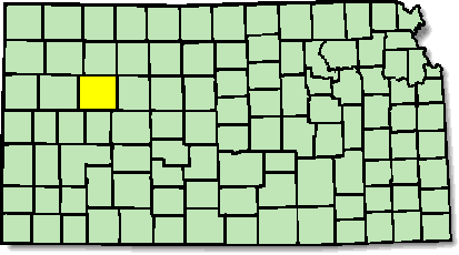
Gove County area of an 1895 Kansas map
..... provided by Pam Rietsch. Check out Pam's great U.S. 1895 map project at http://www.livgenmi.com/1895. THANKS FOR PUTTING UP THIS GREAT SERVICE, PAM! Once you get to the map and want to return to this page click on your BACK button.
Gove County section of an 1897 Kansas map .......... one of the Galbraith's railway mail service maps of Kansas. Take note of the great illustrations on this map. Once you get to the map and want to return to this page click on your BACK button. (Click HERE to go to an online collection of maps provided by the Library of Congress of maps from all over the world. Among the maps you'll find here is the map of Kansas from which this Gove County section is taken.
Assistant State Coordinator Nancy Trice
Madisonville, KY
ksgenweb@usroots.com
Background and KSGenWeb logo were designed and are copyrighted
by
Tom & Carolyn Ward
for the limited use of the KSGenWeb Project.
Permission is granted for use only on an official KSGenWeb page.
The USGenWeb Logo was designed by Linda Cole.Last updated 4/19/99